Nic Barbera of the Texas Department of Transportation answers WPNA questions
WINDSOR PARK NA – Question and Answer
GENERAL
1. Where can I find general information about the Central project, including the schematic, Final
Environmental Impact Study, and details on construction?
Interested parties are encouraged to visit the My35CapEx.com website to learn more about the I-35
Capital Express Central project. This website includes links to the:
- Project Fact Sheet
- Project schematic
- Final Environmental Impact Statement (FEIS))
On the Central project page, you can also view project renderings, a list of previous project events,
and much more.
2. Why is the expansion moving forward?
The I-35 Capital Express Central project is needed because I-35 between US 290 East and SH
71/Ben White Boulevard does not adequately accommodate current and future travel demand and
does not meet current federal and state design standards. This has resulted in safety and
operational deficiencies, which can impact crash rates and peak travel times for all users, including
emergency response vehicles and transit.
CONSTRUCTION
3. How are you going to keep traffic flowing on I-35 during construction?
During construction, TxDOT has committed to maintaining three traveling lanes in each direction to
sustain mobility and accessibility along the corridor. Detailed traffic control plans and project
phasing are currently in development and will be available by mid-2024.
4. When will construction actually begin? How long do you anticipate construction to take?
Construction for the I-35 Capital Express Central project is anticipated to begin mid-2024 and
expected to be completed 2032.
5. At what point will our driving be affected by construction?
Construction of the I-35 Capital Express Central project will begin at the southern end of the
corridor between Lady Bird Lake and SH 71/Ben White Boulevard. Detailed traffic control plans and
project phasing are currently in development and will be available by mid-2024.
6. What is the timeline for construction of the Capital Plaza pedestrian bridge?
Detailed project phasing, including the construction of the pedestrian bridge at Capital Plaza, is
currently in development and will be available to the public by mid-2024.
7. Are you anticipating more traffic on Cameron Road/Berkman Drive during construction?
As standard practice, TxDOT only uses state roadways for detours during construction.
8. What is the plan for the TX thrift store property lot (once acquired)? Staging? Construction
materials?
Right-of-way acquisition is dictated by the needs of a project. Once land has been acquired by the
state it will be used for a variety of purposes that support the planned construction improvements,
including construction staging, drainage, utility installations, pedestrian accommodations, etc.
9. What is the long-term plan for the site (TX thrift store)? Keep it? Sell it back for redevelopment?
TxDOT does not have any plans for this area at this time.
10.Can they wall/ fence it (TX thrift store property) if it is a staging ground?
TxDOT does not have any plans for this area at this time.
11.Where is TxDOT proposing temporary and permanent noise walls along the project corridor?
TxDOT is proposing permanent noise walls (or barriers) at four locations along I-35, including:
- Grace Woods Apartments, 3209 S I-35 Frontage Rd, Austin
- Motel 6, 2707 Interregional Highway South, Austin
- Berkshire Apartments, 1300 E. Riverside Drive, Austin
- Northbound I-35 frontage road at 29 Waller Street, Austin
Temporary perimeter fencing will be in place at the drainage drop shaft areas which could help
reduce noise impacts during construction. The following is a list of locations for temporary fencing
along the corridor: River Street, Brushy Street, 11th Street, 15th Street, Edgewood Avenue, the
Hancock Center, and Airport Boulevard.
12.During construction, could you point out the places motorists and bicyclists could cross I-35 from
32nd street to US 290?
As a part of the Central project, TxDOT will be reconstructing bridges at 32nd Street, 38 1/2 Street,
Wilshire Boulevard, and Airport Boulevard. While detailed traffic control plans and project phasing
are currently in development, TxDOT will maintain access to east-west crossings at 51st Street and
US 290 East.
13.After construction, could you point out the places motorists and bicyclists could cross I-35 from
32nd street to US 290?
Future east-west crossings along I-35 include: 32nd Street, 38 1/2 Street, Wilshire Boulevard,
Airport Boulevard, 51st Street and US 290 East. TxDOT will also be constructing a
pedestrian/bicyclists-only crossing above I-35 at Capital Plaza.
14.Is TxDOT developing a construction app for the Central project?
*Last Updated: 8/10/2020
TxDOT is collaborating on a construction app with multiple regional transit agencies, which will be
developing and constructing infrastructure projects during construction of the I-35 Capital Express
Central project. The app will show overlapping construction activities and lane closures/reductions
from all ongoing efforts.
This app is still in development and will be launched ahead of construction beginning on the Central
project.
ACCESS
15.With the closing of numerous exit/entrance ramps, does TxDOT anticipate that large amounts of
local traffic will be pushed onto side streets?
TxDOT is committed to providing access routes along the I-35 mainlanes or frontage roads for
traffic that is detouring due construction activities. Detailed traffic control plans are currently in
development and will be available by mid-2024.
16.How will the neighborhood access US 183 North?
Access to US 183 North will be available via Barbara Jordan Boulevard to turn right onto the
northbound I-35 frontage road and merge onto the northbound I-35 bypass lane under 51st Street
to enter the mainlanes. While on the mainlanes, traffic will use the existing northbound I-35 to
northbound US 183 flyover.
17. Will we be able to get on I-35 between 51st Street and US 290 in order to access US 183 W?
The existing Central project design does not provide an access point from the northbound I-35
mainlanes to northbound US 183. Drivers will use the northbound I-35 frontage road and enter the
bypass lane under St. Johns Avenue to turn right at the signalized intersection at US 183. Users can
enter the northbound US 183 main lanes after North Lamar Boulevard.
18.Would like to know more about ped/bike access at US 290? (Compare proposed plans with
existing? Currently, there are 4-6 ft sidewalks along the northbound and southbound I-35 frontage roads and
eastbound and westbound US 290 East. TxDOT will improve these bicycle and pedestrian
accommodations by constructing 8-10 ft shared-use paths which will connect to other bike/ped
accommodations in the area.
19.How will I access the west side of I-35?
Access to the west side of I-35 will not change from the existing conditions. Depending on your
starting location, traffic will use east-west access routes along US 290 East or at 51st Street.
FUNDING
20.What assurances are there that this project will come in on budget?
Project costs, including the cost of materials and availability of labor, are impacting all of us. TxDOT
has anticipated these cost increases and made proposed design changes to reduce overall costs,
such as reducing right-of-way impacts. TxDOT also changed the construction method from design
build to design-bid-build to help shift the risk associated with the project and ensure that the best
contractor will be selected for this project.
RIGHT-OF-WAY IMPACTS
21.What are the impacts to the TX thrift store property in its entirety (TX Thrift + parking + Autozone to
the dry cleaners)?
Full acquisitions of the buildings and properties housing the TX thrift store, AutoZone Auto Parts
and First Rate Fixture are underway as part of the Central project.
22. How many people are displaced from homes due to the project?
The Preferred Alternative would require the acquisition of approximately 54.1 acres of additional
ROW, resulting in 111 displacements.
23.Will TxDOT support businesses and neighbors losing their spaces/homes?
TxDOT recognizes the sensitive issue for residents and businesses whose properties are being
impacted along the corridor and is working with impacted tenants and businesses to make the
relocation process easier.
Relocation assistance and reimbursement is available and our right of way specialists work with
individuals to explain how it works.
DESIGN
24.Is there an opportunity to add a pedestrian crossing at the Mueller Greenbelt?
A potential pedestrian crossing at the Mueller Greenbelt is being reviewed by the City of Austin.
Once the City develops and proposes plans, TxDOT will review the design for potential incorporation
into the Central project.
25.What is the cap and stitch program?
A cap is a large deck plaza that covers portions of a sunken freeway that can be designed to
support soil, trees, people and buildings.
A stitch is a widened bridge over a lowered highway that runs east to west with wide sidewalks, bike
lanes, seating areas and supportive green space that reduces noise and sound pollution and
makes crossing safe and inviting.
The City of Austin and the University of Texas will determine locations for TxDOT to accommodate
deck plazas and fund the surface-level enhancements.
The City and UT will also fund operations and maintenance of the surface-level enhancements
throughout the life of the project.
While these local enhancements would be funded by others, TxDOT has designed the preferred
alternative to accommodate for up to 33 acres of caps throughout downtown Austin.
26.Where are caps and stitches being proposed along the Central project corridor?
Potential cap and stitch locations along the corridor are available for review online.
 Loading…


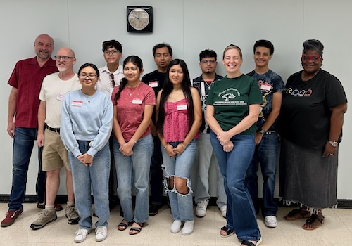 2024-2025 Scholarship recipients being recognized at our June WPNA meeting.
Please support our scholarship effort by contributing below through our secure Zeffy Form.
2024-2025 Scholarship recipients being recognized at our June WPNA meeting.
Please support our scholarship effort by contributing below through our secure Zeffy Form.